No results found
We couldn't find anything using that term, please try searching for something else.

The Brothers’ War/Retro Artifacts
The Brothers ' warRetro ArtifactsSet Informationset symbol Symbol description Four-pointed star on a cogRelease date November 18, 2022plane Domina
| The Brothers ‘ war Retro Artifacts |
|
|---|---|
| Set Information | |
| set symbol | |
| Symbol description | Four-pointed star on a cog |
| Release date | November 18, 2022 |
| plane | Dominaria |
| Set size | 63 ( regular and schematic ) |
| expansion code | BRR[ 1 ] |
| Bonus sheets | |
| Magic: The Gathering Chronology | |
expansion symbol
Retro Artifacts is a non-Standard set of cards associated with The Brothers ‘ war.[ 2 ][3]
Description[ |]
Like Strixhavens Mystical Archive, the Retro Artifact series is similar to the Masterpiece Series, but the cards appear more frequently in the boosters of the main set. These will only be legal in formats that they are already legal in. They are not part of the Standard environment. However, the cards may be used in Limited events. In a Sealed Deck tournament, those cards are part of your card pool. In a Booster Draft tournament, you must draft those cards for them to be included in your card pool.

Serialized card (example)
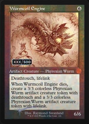
Retro frame artifact classics feature their own expansion symbol and can be found in Draft, Set, and Collector Boosters.[ 2 ] They come in three versions: regular retro frame, “retro schematics” and serialized “retro schematics” with double-rainbow foiling. The serialized cards are numbered with their number out of 500, and they’ll only be available in Collector Boosters.[3]
You can find one Retro Artifact per set/draft booster. There are uncommon, rare, and mythic rare retro artifact cards. Regular and foil versions are available in set/draft boosters. There are 63 of these cards in total, each with a schematic and a regular version.[ 4 ][3]
MTG Arena[ |]
The Retro Artifacts will be available in The Brothers ‘ war drafts on Magic: The Gathering Arena and will be legal in Historic. Mishra’s Bauble was preemptively banned from Historic and Phyrexian Revoker was preemptively banned from Historic Brawl.[ 5 ][6]
Card list[ |]
rarity shift[ |]
rarity shift since their last printing:


