No results found
We couldn't find anything using that term, please try searching for something else.
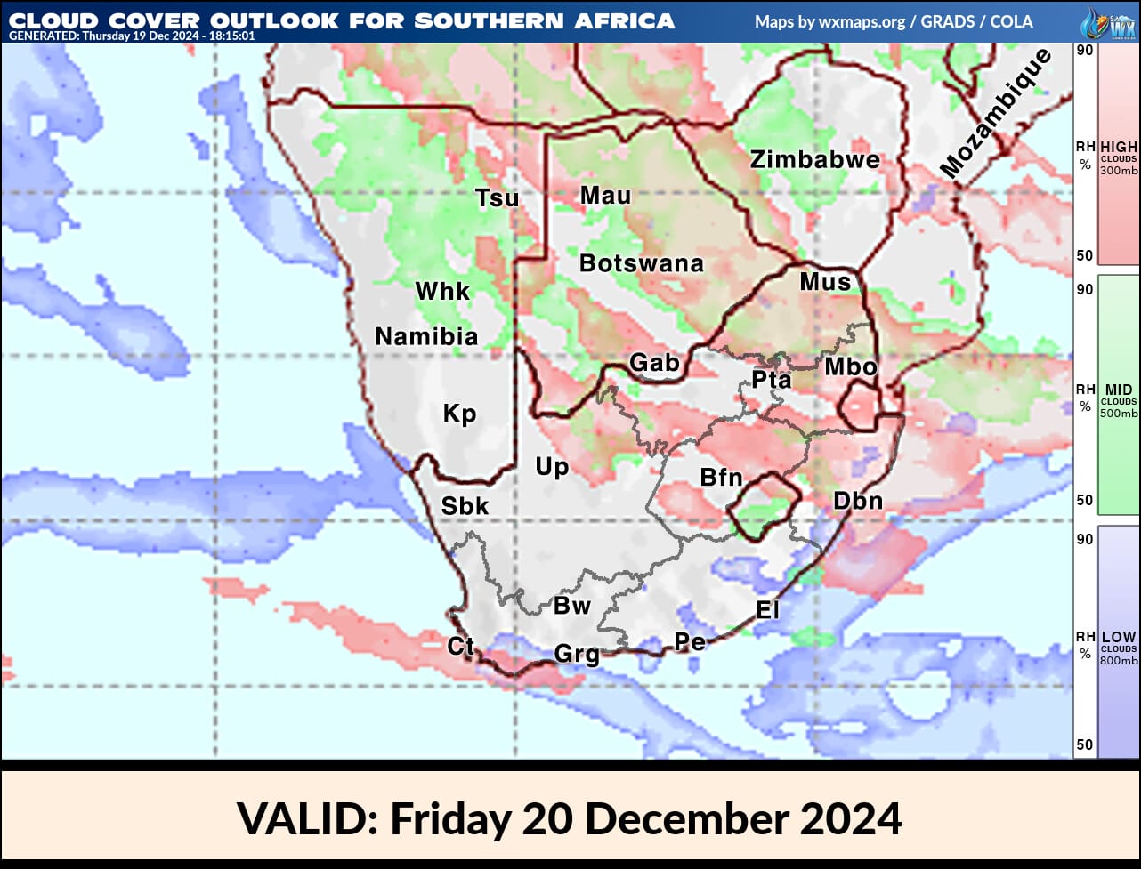
2024-12-22 Cloud Cover Maps for South Africa Live Satellite Images for Southern Africa Clouds Cover, Cloud Stream, Radar and Rainfall Maps - Copyright 2024 SSEC
Related articles